1. The Environmental Monitoring Problem Nobody Solved Until Drones
A water quality technician spends three hours driving to a reservoir, 45 minutes launching a boat, 20 minutes collecting three surface samples from pre-marked GPS coordinates, and three hours driving back. The entire day produces nine sample vials — all from the top 30 centimeters of the water column, all from reachable locations near the shoreline. The middle of the lake, where thermal stratification creates distinct chemical layers at 5, 10, and 15 meters below the surface, goes entirely unsampled.
Gas monitoring on industrial sites faces the same geometry problem. A fixed ground station measures air quality at one elevation — typically 2 meters above ground. But a chemical plant's emission plume rises, disperses, and reacts with atmospheric ozone at 50, 100, and 200 meters. The readings at ground level tell you what's happening at ground level. They do not tell you what's drifting across the facility boundary at stack height.
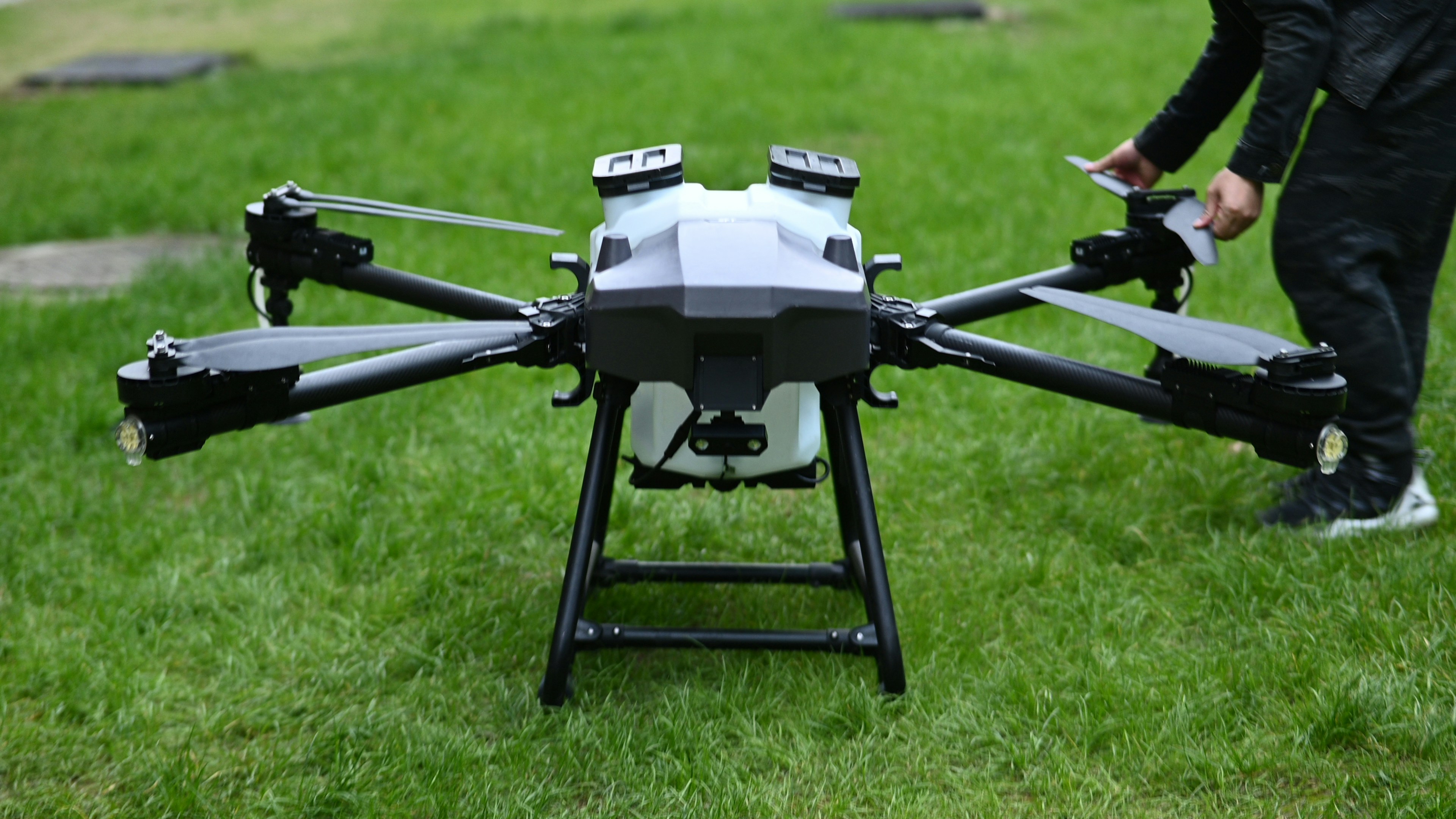
A DJI Matrice 350 RTK carrying a water sampling winch on one payload port and a multi-gas sniffer on the other solves both problems in a single flight. Here is how the integration works — from the pump to the plume map.
2. Water Sampling From a Drone: More Than Lowering a Bucket
2.1 Depth-Controlled Collection
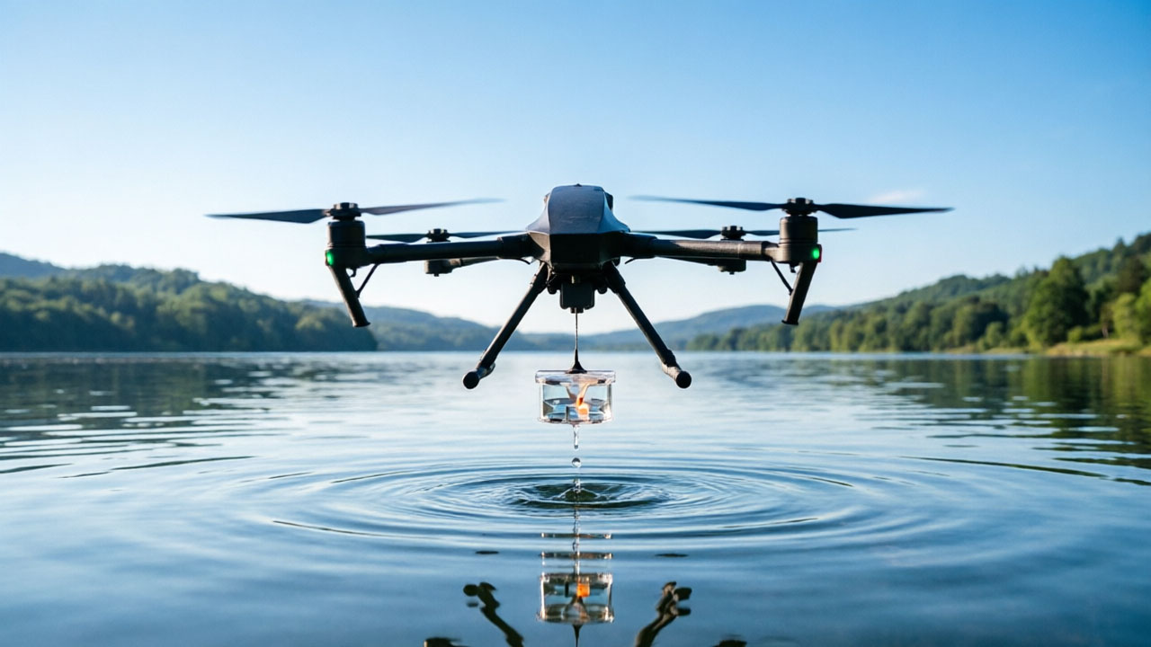
Surface sampling is easy. Any container on a rope can collect the top layer. Depth-specific sampling — collecting water from exactly 8 meters below surface, at a GPS coordinate that cannot be reached by boat — requires four things working together:
- RTK positioning: Centimeter-level GPS holds the aircraft stationary above the sample point. Without RTK, a 2-meter position drift moves the sampler outside the target column, and the collected water represents a different location than the logged coordinates.
- Precision winch control: A millimeter-wave radar or LiDAR altimeter measures the exact water surface height, then lowers the sampling container to the programmed depth (typically 0.5-25 meters). The difference between intended depth and actual depth must stay within a few centimeters — at 8 meters, a 20-centimeter error means you're sampling water from a different thermal layer.
- Auto-pipe cleaning: Between samples, the system pumps clean water through the intake line to purge the previous sample. Without this purge cycle, residual water from Sample A at Depth 5m contaminates Sample B at Depth 15m, rendering the depth profile data unreliable.
- Emergency release: A mechanical cutter severs the sampling line if the winch cable snags on submerged debris or vegetation. A stuck cable at 15 meters depth creates a dangerous pendulum load on the aircraft. The release mechanism, activated from DJI Pilot 2, drops the payload and allows the drone to return safely.
2.2 Sample Integrity: Keeping the Evidence Chain Intact
For regulatory or litigation-grade water sampling, the chain of custody matters as much as the water quality data itself. A properly integrated drone water sampling system records per-sample metadata: GPS coordinates (RTK, ±2cm horizontal, ±3cm vertical), collection depth (verified by winch encoder, not estimated), water temperature at depth (from an onboard thermistor), collection time (UTC, synced from aircraft GNSS), and sample ID (auto-incremented, linked to the flight log in DJI FlightHub 2). This data package satisfies EPA, EU Water Framework Directive, and most national environmental agency documentation requirements for court-admissible evidence of discharge violations.
3. Gas Sensing: Turning a Drone Into a Flying Chemistry Lab
3.1 What a Multi-Gas Sensor Array Measures
Compact gas sensor payloads — typically 200-250 grams — now monitor up to 10 parameters simultaneously from a single PSDK port on a DJI Matrice 350 or M400. The sensor suite includes:
- Volatile organic compounds (TVOC): Photoionization detector (PID), 0-50 ppm range, 1 ppb resolution. Detects solvent vapors, fuel spills, and industrial degreasing emissions.
- Combustion byproducts: SO₂ (0-20 ppm), NO₂ (0-10 ppm), CO (0-50 ppm), O₃ (0-5 ppm). Electrochemical sensors, each calibrated to the target gas. Cross-sensitivity between gases is compensated in software.
- Particulate matter: PM1.0, PM2.5, PM10 — laser scattering principle, 0-1,000 μg/m³ range. Identifies dust, smoke, and aerosol concentrations at altitude.
- Methane (CH₄): Tunable Diode Laser Absorption Spectroscopy (TDLAS) sensor with 1 ppm sensitivity. This is the sensor that finds pipeline leaks from 50 meters altitude — the laser beam reflects off the ground and measures methane absorption in the optical path.
- Additional parameters: H₂S (0-10 ppm), NH₃ (0-20 ppm), CO₂ (400-5,000 ppm) — each with dedicated electrochemical or NDIR sensors.
3.2 Vertical Profiling: The Data That Ground Stations Miss
The drone flies a vertical profile: hover at 10m, sample for 30 seconds; climb to 50m, sample for 30 seconds; climb to 100m, sample again. The resulting data shows how an industrial emission plume disperses with altitude — information that a ground-level air quality monitor, no matter how accurate, cannot provide. This vertical concentration gradient is what environmental regulators use to validate dispersion models and determine whether a facility's stack height is adequate for the local topography and prevailing wind patterns.
The Sniffer4D Mapper software generates 2D and 3D plume maps from the flight data, overlaying gas concentration grids on satellite imagery. A refinery operator can see exactly where their SO₂ plume crosses the facility boundary — and at what concentration — in real time during the flight, not days later in a lab report.
4. Integrated Mission: Water + Air in a Single Sortie
The operational advantage of the DJI Matrice 350 RTK's dual payload architecture is the ability to run both monitoring modalities — water sampling and gas sensing — in one coordinated flight:
- Transit to site: Aircraft flies at 80 meters AGL to the first water sampling waypoint. Gas sensors record continuous background readings during transit, establishing an ambient air quality baseline for the flight path.
- Water sampling sequence: At each pre-programmed waypoint, the aircraft descends to 5 meters above water surface, the winch deploys to the target depth, the sample is collected, and the aircraft ascends to transit altitude. Three sampling points at depths of 2m, 8m, and 15m cover the epilimnion, metalimnion, and hypolimnion layers of a stratified lake — in approximately 12 minutes total, including transit between points.
- Gas profiling: After the final water sample, the aircraft climbs vertically through the emission column to 200 meters AGL, recording gas concentrations at 10-meter intervals. The entire vertical profile takes 3-4 minutes.
- Return and data sync: Aircraft returns to landing point. Water samples are labeled, sealed, and transferred to the laboratory chain-of-custody form. Gas sensor data uploads to DJI FlightHub 2 for automated report generation with time-stamped, geo-referenced concentration plots.
5. Platform Requirements: What the Aircraft Needs to Carry This Mission
Minimum payload budget: Water sampler (520g for a 1L winch-based unit with millimeter-wave altimeter and night vision camera) + gas sensor array (200g for a 10-parameter multi-gas sniffer) + mounting brackets (50-80g) = approximately 800 grams total payload. The DJI Matrice 350 RTK's 2.7 kg payload budget handles this with 1.9 kg to spare — enough to add a thermal camera for visually identifying discharge plumes, or a loudspeaker for issuing safety warnings during HAZMAT monitoring.
Dual payload port requirement: The water sampler occupies one gimbal port (SkyPort V2). The gas sensor occupies a second port (PSDK E-Port V2). The M350's dual downward gimbal configuration supports this natively. A single-port aircraft like the M30 series requires sequential operations — sample water first, land, swap payloads, then fly the gas profile — doubling the flight time and losing the continuous ambient air baseline data collected during transit.
RTK requirement: Mandatory for water sampling. Non-RTK GPS accuracy (±2-3 meters horizontal) is insufficient for repeated sampling at the same coordinates over multiple monitoring periods. RTK (±2cm) enables seasonal comparison — the water sample collected at GPS coordinate X in January comes from the same physical location as the sample collected at the same coordinate in July.
6. Three Operational Scenarios Where This Integration Pays for Itself
6.1 Industrial Discharge Compliance Monitoring
A chemical plant's discharge permit specifies maximum effluent concentrations at the outfall point and at a compliance boundary 200 meters downstream. A drone water sampler collects specimens at both coordinates in a single flight, while the gas sensor simultaneously profiles the plant's stack emissions. The integrated data package — water quality at the outfall + air quality at stack height — provides the regulatory agency with a complete compliance picture from a single monitoring event. Traditional methods require separate water and air monitoring teams with different equipment and different schedules.
6.2 Reservoir and Drinking Water Source Protection
Water utilities monitor reservoir quality at intake depth — typically 10-30 meters below surface. Algal blooms, thermal stratification, and dissolved oxygen depletion all occur at specific depth layers that change seasonally. A drone water sampler with depth control collects specimens from the exact intake depth (verified by millimeter-wave altimeter), while the gas sensor profiles methane concentrations above the reservoir surface — an indicator of anaerobic decomposition in the benthic layer that can affect drinking water taste and odor months before it appears in tap samples.
6.3 HAZMAT and Post-Incident Assessment
After a chemical spill or industrial fire, the incident site may be unsafe for ground personnel. A drone equipped with a multi-gas sensor and water sampler can assess air quality above the site at multiple altitudes while collecting runoff water samples from drainage channels — all without exposing a single person to the hazard zone. The real-time gas concentration data transmitted to the incident command post informs evacuation perimeter decisions and PPE requirements for the entry team.
7. Summary: The Platform Makes the Mission Possible
A water sampler is a pump, a winch, and a sample bottle. A gas sensor is an electrochemical cell, a laser diode, and a data logger. Neither is particularly complex on its own. The complexity — and the operational value — comes from the integration: getting both payloads onto one aircraft, flying them through a coordinated mission profile, and producing a single data package that tells the complete environmental story of a site.
The DJI Matrice 350 RTK's dual gimbal architecture, 2.7 kg payload capacity, RTK positioning, and FlightHub 2 data pipeline make this integration possible as a routine operational procedure — not a one-off engineering demonstration. For environmental consultants, water utilities, and industrial compliance teams, the question is not whether drone-based monitoring works. It's whether your current monitoring program is missing the data that only a vertical profile, collected at a GPS coordinate a boat cannot reach, can provide.
Configuring an integrated water and air monitoring payload for your DJI Matrice platform? Contact our technical team with your monitoring parameters — target depths, gas species of interest, and operational frequency — for a payload compatibility review and mission planning support.