A field guide for distributors, resellers and professional buyers. All specs are taken from real product data of the S220 PRO model in the Puyu Drone catalog. Civilian use only; pricing and certifications are excluded — please contact our team for project inquiries.
What is the customer actually asking for when they say "I need to fly at night in the city"?
If you sell drones, sooner or later you'll hear this line: "I need to fly at night in the city. Lots of buildings, lots of power lines, and I'm worried about signal jamming — what if the drone can't get back?"
The customer may not know the exact model name, but the capabilities they want are clear — fly steady, see clearly, dodge obstacles, and come home. The era of "fly anywhere in open daylight" is over. More and more projects in urban security, site inspection and emergency response demand drones that can work between buildings, at night, and in cluttered electromagnetic environments.
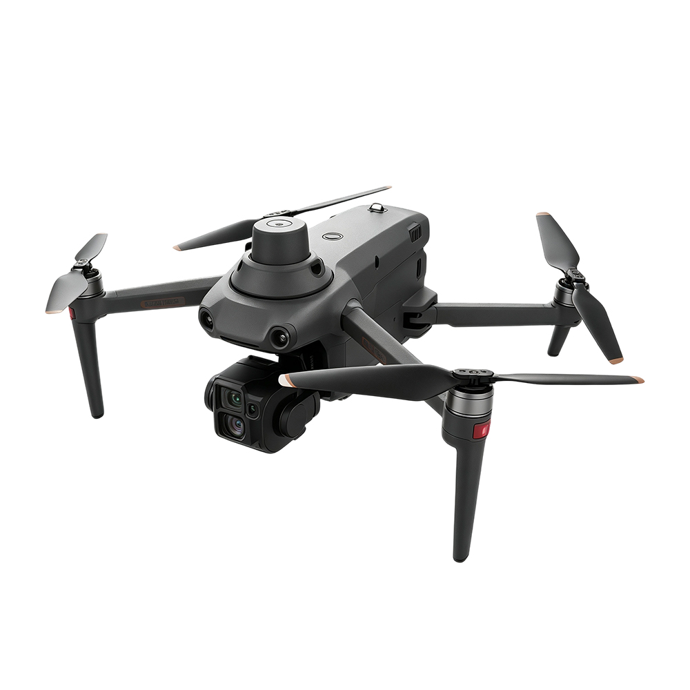
That is exactly where a smart reconnaissance drone like the S220 PRO comes in. It is not built for long range — it is built to finish the job in complex environments and still bring itself home. This guide explains in plain language what it is, how it works, which customers fit, and what you must tell buyers before quoting.
What the S220 PRO is: an industrial drone with on-board AI
First, the real specs (all from Puyu Drone product data, not exaggerated):
| Spec | Value | Spec | Value |
|---|---|---|---|
| On-board compute | 8-core 21 TOPS (domestic AI chip) | Aircraft weight | 1860 g |
| Max takeoff weight | 2050 g | Folded size | 175×272×148 mm (fits a backpack) |
| Unfolded size | 613×699×160 mm | Wheelbase | 486 mm |
| Max flight time | 41 minutes | Max ascend / descend | 8 / 6 m/s |
| Wind resistance | 12 m/s (≈ Beaufort 6) | Max takeoff altitude | 6000 m |
| Max communication range | 15 km (FCC) | Obstacle avoidance | Six-direction binocular AI avoidance |
| Wide-angle camera | 48 MP | Telephoto camera | 48 MP + 10× optical zoom |
| Night vision | 4K full-color starlight night vision | Thermal infrared | 1K IR (640×512 @30fps) |
| Laser rangefinder | 10–1500 m | Gimbal | 3-axis mechanical + EIS electronic stabilization |
In one sentence: most industrial drones are "flying platforms that carry a camera"; the S220 PRO moves the recognition, avoidance and return-to-home judgment that used to live in the ground pilot's brain onto the on-board chip. A 1860 g folding body packs an 8-core 21T compute platform, six-direction obstacle avoidance, dual 48MP cameras, thermal infrared and a laser rangefinder — that is the dividing line between this drone and a regular aerial camera platform.
How it does "AI reconnaissance": four capabilities explained
Many buyers think "AI drone" is a marketing phrase. The S220 PRO's four capabilities are separately engineered, and each solves a real-world problem:
① On-board AI: the aircraft can "see" the picture itself
The traditional inspection workflow is: capture footage → stream it back to the ground → a human watches the screen and looks for targets. Stream quality drops with signal, and humans get tired. The S220 PRO's 8-core 21T chip runs target recognition on-board, marks suspicious targets first, then streams back the result. In multi-drone operations, data is aggregated at the ground station and can be coordinated in the cloud if needed. Recognition happens at the aircraft — that is the fundamental difference from the older "stream back, human watches" inspection drone.
② Six-direction binocular obstacle avoidance: the key is recognizing "thin" objects
Binocular vision sensors face all six directions — front, back, left, right, top and bottom — paired with an AI algorithm that can identify small obstacles like power lines and branches. Why emphasize this? Because in urban and industrial-park environments, the most common obstacles are exactly these thin, line-shaped objects — wires, cables — and most consumer-grade avoidance systems only recognize large obstacles and basically can't see wires. Whether a system can recognize thin lines is the dividing line between industrial-grade avoidance and toy-grade avoidance.
③ Jam-resistant return-to-home: when satellite is jammed, the drone navigates by "reading the road"
This is where the S220 PRO separates from ordinary drones, and why it can work in the cluttered electromagnetic environments of a city.
Ordinary drones return home using satellite positioning (GPS/BeiDou). Once the satellite signal is jammed, the aircraft has no idea where it is. The S220 PRO handles this with two independent paths:
- If the downlink is jammed → the system automatically frequency-hops to a clean channel, preserving control and video between the ground station and the aircraft.
- If the satellite positioning is jammed → the on-board vision system continuously compares feature points on the ground below to estimate its own position — in effect "reading the road home". It doesn't need satellites to know where it is, and can fly back to the takeoff point along the original route.
When both satellite and downlink are healthy, this system is invisible. The moment the signal environment gets messy, it is the safety net that brings the aircraft home. Urban buildings, construction sites and large event-security venues are exactly where these conditions hit hardest.
④ Day and night dual-mode imaging: 4K full-color night vision + thermal infrared
By day, the 48MP wide-angle and 48MP telephoto work together — the 10× optical zoom reads target detail at long range. By night, switch to 4K full-color starlight night vision: even faint moonlight produces a color picture so you see the environment, not just a heat blob. To search for heat sources (people, vehicles, equipment hot spots), switch to thermal infrared — the 640×512 resolution, paired with AI super-resolution, supports 2K stills and 32× super-resolution zoom. One payload covers day and night — the customer doesn't need a separate aircraft for night missions.
Where it fits: six civilian use cases
- Smart city: nighttime municipal infrastructure patrol, illegal-build identification, traffic-node aerial views
- Ecology and conservation: nighttime anti-poaching / anti-illegal-mining patrol, wildlife monitoring (infrared doesn't disturb)
- Smart industrial park: factory perimeter night patrol, large-event venue security coverage
- Energy inspection: substations, solar farms, oil-and-gas pipelines — especially tasks that need nighttime infrared to find equipment hot spots
- Event security: aerial coverage for large sports events and gatherings, mobile monitoring in complex crowd environments
- Emergency and fire rescue: nighttime search and rescue, fire-scene heat-source localization, giving ground command a clear picture before personnel enter
These use cases map to three typical customer groups: government / law-enforcement agencies for urban security and emergency response, energy and industrial-park operators for unmanned inspections, and security companies for event coverage — all legitimate, compliant civilian operations.
The real limits of a smart drone: three things you must say before quoting
Selling a smart drone, the worst outcome is over-promising. We recommend every distributor raise these three points proactively before sending a quote — being upfront actually closes more deals:
① 41 minutes is the ideal no-payload figure; plan jobs at 30–35 minutes. Carrying a payload, windy weather, frequent acceleration and deceleration all cut flight time noticeably — 30 minutes in complex environments is normal. When discussing "how much can we do per sortie" with the customer, plan to 30–35 minutes, never promise 41.
② 15 km is the max communication range under FCC standards. It is not a flight range, and it is not achievable everywhere. Actual usable range depends on local regulations, terrain and electromagnetic environment. In urban buildings it is far less than the open-area nominal figure. Make this clear to the customer — don't let them think it means "can fly 15 km".
③ Smart features all have conditions of use:
- Vision-based return-to-home depends on ambient light and ground texture. In pitch-black, dense fog or strong backlight, visual positioning can fail — when satellite is healthy the aircraft doesn't depend on vision, but if satellite is also jammed under those conditions, the pilot must take over.
- AI obstacle avoidance is an assistance system — it cannot guarantee avoiding every obstacle. Thin lines, glass and transparent objects are industry-wide known challenges; the pilot bears final responsibility for flight safety.
- 6000 m is the maximum takeoff altitude, not a guarantee that the drone works perfectly at any altitude. At high altitudes, power and endurance both drop.
Why the market is growing: data points to "AI + urban security"
Distributors judge whether a category is worth entering by three things: how big is the market, where is it growing, and does it line up with the product we have. Here is third-party data you can verify:
- The global AI drone market was about USD 20.4 billion in 2025, projected to reach USD 23 billion in 2026, with the Middle East and Africa accounting for 9.11% (≈ USD 1.86 billion) and growth accelerating (Fortune Business Insights).
- The drone market with obstacle-avoidance functionality was about USD 3.15 billion in 2025, with industrial inspection accounting for ~35% of downstream use cases (PW Consulting) — "avoidance + inspection" is the most concentrated combination of buyer needs, and the S220 PRO's main track.
- The UAV Sense-and-Avoid market was about USD 880 million in 2025 with a 7.1% CAGR; MEA accounts for 5%, led by the Gulf countries; the report specifically names UAE National Drones Programme and Saudi Vision 2030 as regional growth drivers (Dataintelo) — Saudi and UAE government projects are growing, and they are in our target market.
One sentence: "AI + urban security" is not a niche — it is a category being pushed forward by government projects in the Middle East and Africa. And in this category, suppliers who can provide professional selection consulting and in-depth technical content are still few — build that expertise now, and your customers will remember you.
FAQ
Which customers should buy the S220 PRO?
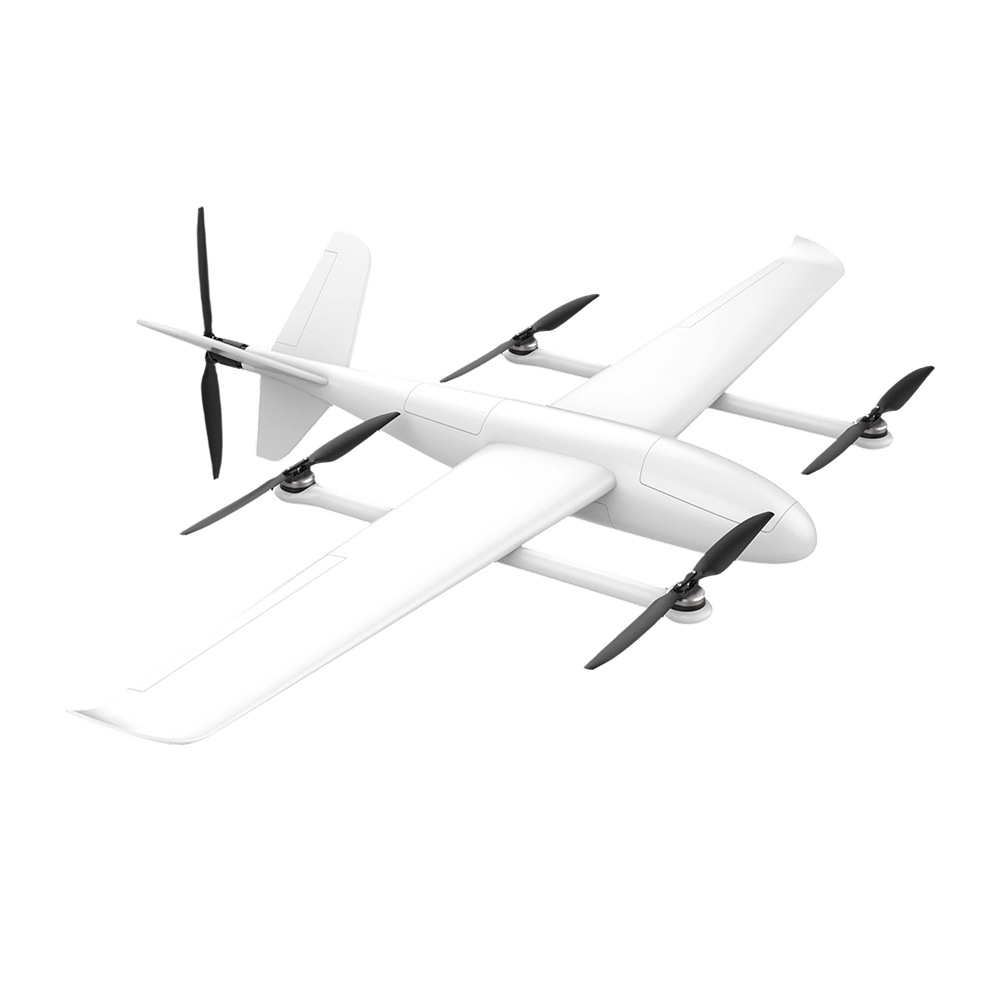
Urban security (government / law enforcement), unmanned inspection in industrial parks and energy facilities, security companies covering nighttime events, and emergency and fire-rescue teams for nighttime search — these customers need "stability in complex environments, clear imaging, and reliable return", which is exactly what the S220 PRO does well. If the customer needs wide-area mapping in open terrain, a long-endurance VTOL fixed-wing platform is a better fit.
How long does the 41-minute flight time last in practice?
41 minutes is the ideal no-payload figure. With payload, expect 30–35 minutes; wind, frequent acceleration, and high altitude reduce this further. For job planning, plan to 30–35 minutes.
How does vision-based return-to-home work, and when is it needed?
Ordinary drones rely on satellite positioning to return home, and lose their position reference when satellite is jammed. The S220 PRO's vision-based return-to-home uses on-board vision to compare ground features in real time and estimate its position, then returns along the original route — effectively "reading the road home". It is most needed in the cluttered electromagnetic environments of urban buildings, construction sites and event venues. But it depends on ambient light and ground texture — it can fail in pure black or dense fog.
What is the difference between night vision and thermal infrared?
Night vision amplifies faint light into a visible image (the S220 PRO is full-color starlight night vision, producing a color image at night) and is suited to seeing environmental detail. Thermal infrared detects temperature differences and displays heat-emitting objects, suited to finding people, vehicles and equipment hot spots. They serve different purposes; the S220 PRO has both and switches between them per task.
Can AI obstacle avoidance fully replace the pilot?
No. AI obstacle avoidance is an assistance system — it can recognize wires, branches and other common obstacles, but thin lines, glass and transparent objects remain industry-wide challenges. No smart feature can replace the pilot's ultimate responsibility for flight safety — this is also the basic requirement of drone regulations everywhere.
Is this product civilian or military?
Civilian / industrial use. The S220 PRO is for legitimate, compliant civilian operations in urban security, energy inspection, industrial-park management, emergency response and the like.
Customization and "Off-Catalog Sourcing"
The S220 PRO's payload options can be tailored to the project: our in-house gimbal series (AI tracking gimbal, thermal imaging gimbal, zoom gimbal) can all be configured to the task. If the customer's project requires a model or payload that isn't on the website, feel free to tell us directly — our supply chain can source to project requirements, which is what differentiates Puyu Drone from a regular distributor.
---
For more selection details or to send an inquiry, tell us what you need and our engineering team will provide a project-by-project plan.
Related reading: FPV Reconnaissance Drone Selection Guide, FY-VT04 Long-Endurance VTOL Field Guide, TS100 Heavy-Lift Cargo Drone Field Guide.