Commercial Drone Applications by Industry: One Year Later, What the 2025 Data Got Right
In 2026, mapping & surveying and industrial inspection have become the most solid commercial drone use cases. That picture was already clear a year ago — the 2025 drone industry report showed surveying & mapping (35%) and inspection (26%) accounting for nearly two-thirds of the market. Looking back now, those numbers were not just accurate; they predicted several of this year's key trends. This article revisits the real use cases behind the data, industry by industry, and explains which airframe and payload combination actually gets the job done.
Why Industries Are Adopting Drones in 2025
The 2025 drone industry report surveyed 768 drone companies across 87 countries on how and why they fly. Looking back at those answers one year later, three findings stand out before we even get to individual use cases:
- Saving time is now the #1 reason for adopting drones, followed by improving quality. This is a notable shift: for years, "improving work safety" was almost always the top reason — it has now slipped to third place.
- Survey respondents concentrate in agriculture, construction and energy — the three sectors where ground-based manual data collection is slowest and most expensive.
- Operators fly mostly data missions: mapping & surveying (35%), inspection (26%) and photography & filming (18%). Delivery, spraying and localization/tracking are smaller but growing, each at 5–7%.
The common thread: drones replace hours of manual field work with one flight that captures more data, at higher resolution, in a fraction of the time.
Surveying & Mapping — the Largest Drone Application (35%)
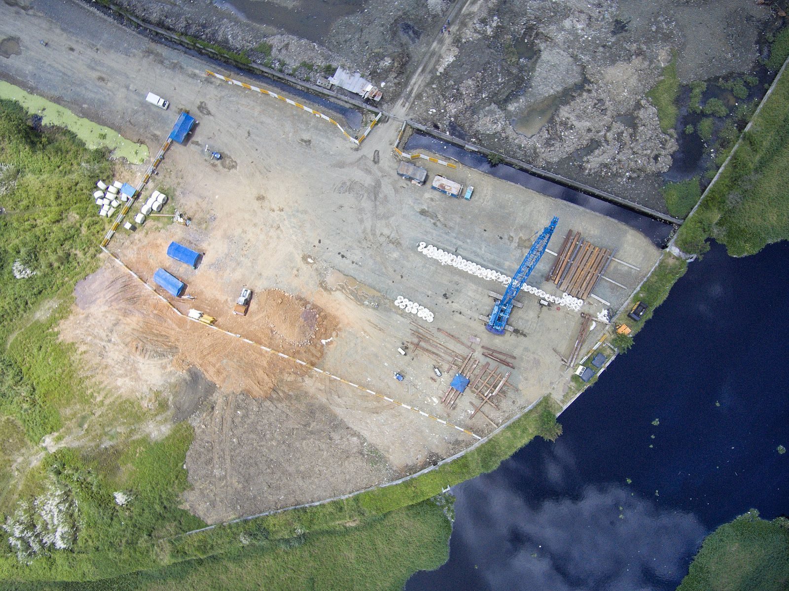
Mapping & surveying remains the dominant commercial drone use case, a share that has held steady for years (34% in 2022 and 2023). Surveyors, construction firms and mining operations use it to turn a site into measurable 3D data in a single flight.
Why it wins: a small crew and one aircraft can capture topographical data that a walking survey crew would need days to collect. RTK positioning and post-processed photogrammetry deliver centimeter-level accuracy without putting personnel on unstable terrain.
Real-world example: a construction site needs progress volumes for earthwork billing. A drone with a high-resolution camera flies the site in 20 minutes, the point cloud is processed the same day, and the volumetric report lands on the project manager's desk before the crew leaves. Manual measurement of the same area would occupy two engineers for most of a week.
Two approaches dominate, and the choice between them matters — our guide on LiDAR vs. photogrammetry for drone surveying explains the accuracy, cost and processing trade-offs of each method in detail.
Industrial Inspection — 26% and Still Growing
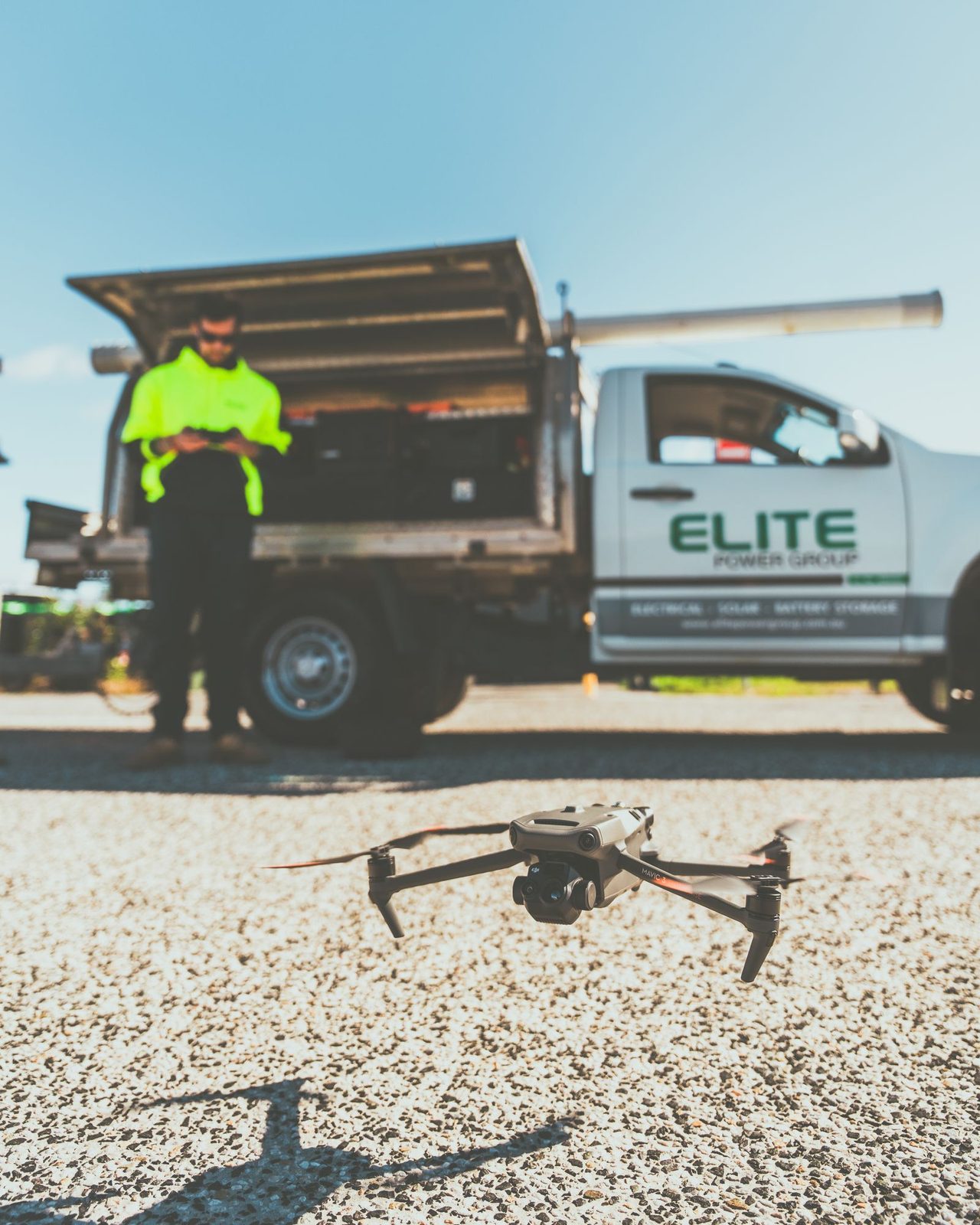
Inspection is the second-largest drone application, and in sectors like energy and utilities it is often the first drone use case a company invests in. The reason is straightforward: inspections that require rope access, scaffolding or shutdowns can be done in a fraction of the time — and from angles a human inspector would never reach.
Power line inspection. Utilities fly drones along transmission corridors to detect insulator damage, corrosion and vegetation encroachment. With AI-assisted defect recognition, the flight crew no longer reviews every frame manually — the onboard pipeline flags suspect regions, and the inspector only verifies the flagged frames. We covered this workflow in detail in our article on AI-based defect detection for power line inspection.
Solar and rooftop inspection. A thermal camera sees hot cells and bypass-diode failures that are invisible to the naked eye. One operator can scan several hundred panels per flight and deliver a heat-map report with the exact panel coordinates that need replacement. This is a classic example of drones doing inspection safely — no one climbs onto a roof to find a failing panel.
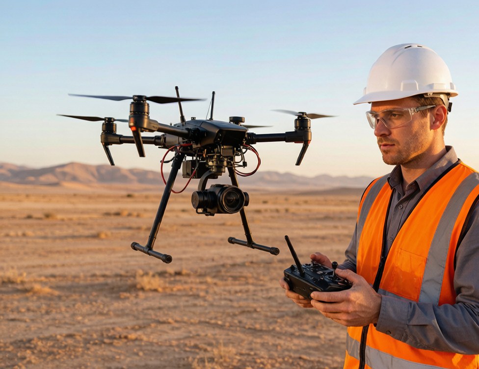
Critical infrastructure. Bridges, cooling towers, tanks and flare stacks are typically inspected with a zoom gimbal (e.g., 20–30× optical zoom) [需人工核对] so the inspector can get close-up detail from a safe standoff distance, and with a thermal payload where temperature anomalies matter.
Inspection drones also cut downtime: a refinery inspection that once required a planned outage can now be scheduled during normal operation.
Agriculture — Spraying & Dispensing (7% and Growing)
Agriculture is one of the three sectors where the majority of survey respondents are active, and spraying & dispensing is the fastest-growing method in the survey. The value chain spans two distinct jobs:
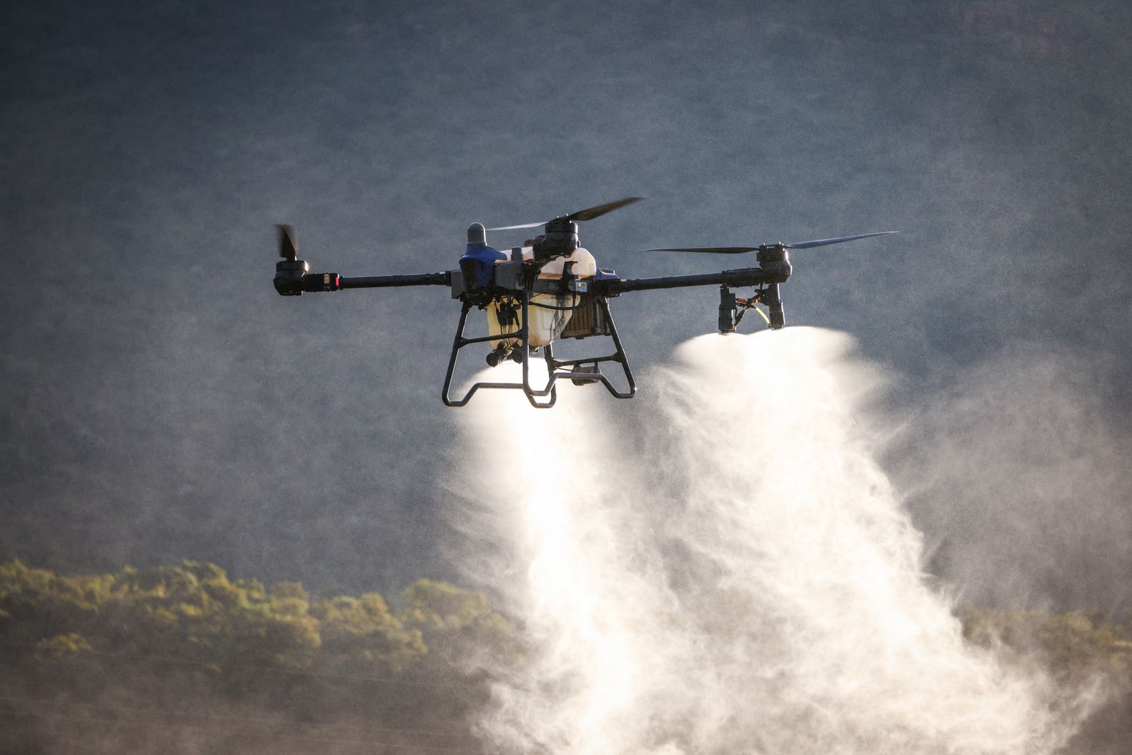
Precision spraying. A spraying drone carries a liquid tank and a pump-and-nozzle system, applying pesticide or fertilizer only where it is needed. This is not just about speed — it keeps ground crews away from chemical exposure and works in fields where wheeled sprayers would compact the soil or cannot reach at all.
Dispensing and seeding. Beyond spraying, dispensing systems handle targeted seeding and granular fertilizer application. For rice paddies and hilly terrain, a drone is often the only practical way to distribute inputs evenly.
Spraying drones are weight-limited by design — check the tank capacity, nozzle flow rate and the recommended flight speed for your crop type before committing to a model. Our agriculture drone selection guide breaks down the payload options and the crop-by-crop math.
Delivery & Logistics — 7% and Climbing
Delivery sits at 7% of operator activity — and the 2025 report's expectation that it would keep rising has held up. Use cases split into two categories:
- Last-mile delivery — medical samples, lab specimens and time-critical parts flown point-to-point, bypassing ground traffic.
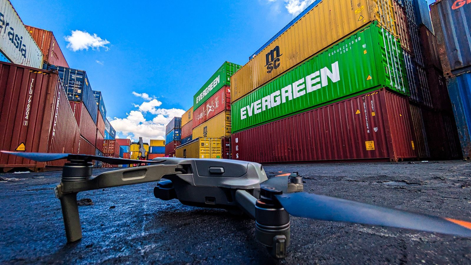
- Site logistics — carrying tools, batteries and small components across large construction, mining or warehouse sites, where a ground vehicle trip can take 20 minutes and a drone makes it in three.
BVLOS (beyond visual line of sight) clearance remains the biggest constraint on delivery scale — it is consistently cited as a regulatory obstacle in the survey. Until BVLOS rules mature, most commercial delivery runs stay within visual line of sight, which keeps missions short and the payload under a few kilograms.
Public Safety & Emergency Response — Thermal, Audio and AI
Public safety is where the survey's quieter methods — thermal, audio, tracking — combine into a single high-stakes workflow. Our site's own solution set (public safety, emergency response, traffic enforcement) is built around three payload types:
Thermal + speaker. A fire crew arrives at a smoke-filled scene with zero visibility. A thermal camera sees through the smoke to locate hotspots and persons, while the speaker payload gives ground command a direct voice channel: "The exit is 30 meters to your left — follow the strobe." This combination is the backbone of the firefighting thermal + speaker drone configuration we documented with a rescue team.
AI tracking module. For perimeter security and law enforcement, an AI-based tracking module keeps the camera locked on a moving subject while the operator stays hands-off. Combined with a searchlight, this turns one officer into an aerial overwatch position that can cover terrain no patrol car can reach.
Rapid aerial response. In the first minutes of an incident, a drone that launches from a dock (drone-in-a-box) can be on station before ground units arrive, streaming live video to the command post. That window — the first few minutes — is exactly when situational awareness matters most.
Our perimeter security drone setup guide walks through the camera, tracking and alerting hardware for 24/7 site monitoring.
Localization & Tracking — Small but Strategic (5%)
At 5%, localization & tracking is the smallest surveyed method, but it is also the least camera-dependent. The report notes that "other" methods in this category are mostly non-optical payloads: LED spotlights, ultrasonic sensors, magnetometers and ground-penetrating radars.
Practical examples:
- Ground-penetrating radar for subsurface utility mapping and archaeological survey — a payload that sees through soil, not just over it.
- Magnetometer payloads for locating buried ferrous objects, including unexploded ordnance on former training ranges.
- Ultrasonic sensors for precision altitude control in confined environments where barometric sensors drift.
This segment is a reminder that a drone's usefulness is defined by its payload, not its airframe — the same flight platform can carry a camera one week and a ground-penetrating radar the next.
What the 2025 Data Got Right: Where the Market Is Heading
Beyond the use cases, the same 2025 data predicted three structural trends — and a year later, all three have held up. They still shape procurement decisions today:
1. Software is the market's biggest winner — hardware is healthy. Software providers report the strongest development (7.2/10, expectations of 8.0), while drone component and system manufacturers sit at 7.1 actual development with 7.4 expectations for the next 12 months. Drone manufacturers hold steady at 6.5.
The demand for ready-made, application-specific platforms pushed custom integration/engineering companies to the sharpest decline (expectations 5.5) — buyers increasingly buy configured solutions rather than paying for bespoke engineering.
2. Regulation is the #1 challenge and the #1 market driver at the same time. 61% of respondents named rule-making authorities as the most important market-driving actor — up from 57% last year. The same regulatory environment (certification, BVLOS, night operations) ranks as the industry's biggest obstacle. Expect compliance to shape which platforms and payloads are actually usable in your region.
3. The funding tap is tighter. Acquiring funding to scale rose from 8th place (2023) to 3rd place in this year's challenge ranking, and geopolitics (+0.7) was the challenge that increased the most. For buyers, this means the equipment that ships today needs to be reliable out of the box — there is less appetite for paying for integration work that could have been specified up front.
How to Spec Your Drone Platform for Your Industry
Every industry above runs on the same principle: define the payload first, then the airframe. Before you ask "which drone should I buy?", answer these four questions:
- What sensor does the job? Camera, zoom gimbal, thermal, speaker, searchlight, sprayer or dispenser — the payload defines the mission.
- What flight time does the mission need? Distinguish hovering time from cruise flight time; a docked platform can compensate for shorter endurance with automatic battery swaps.
- What is the operating environment? Temperature range, wind exposure, dust and moisture — specify an IP-rated build that matches the site, not a generic "weatherproof" claim.
- What integrates with your workflow? The data has to land in your existing software — mapping outputs, inspection reports, alarm feeds — without a custom engineering project.
We manufacture the airframes, gimbals and payload modules (zoom, thermal, AI tracking, speaker, searchlight, dispenser) used across all the use cases above, so we can spec a complete package rather than asking you to source parts from five vendors.
Tell us your operating environment and airframe model — we'll put together a tailored payload configuration with CAD drawings and a compatibility check, and our technical team can confirm it against your existing fleet within one business day. Use the chat button on this page or send us an inquiry; every configuration we ship is validated against the real operating parameters you give us.
Source: 2025 drone industry report (global survey of 768 drone companies across 87 countries). Figures cited above are from this report.